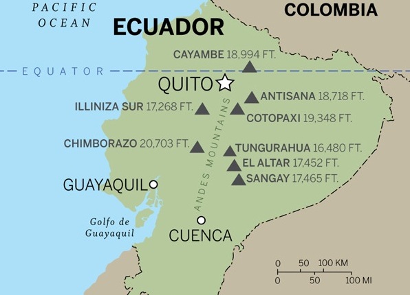
- Address: Ecuador, Cotopaxi Province, Quito;
- The structure includes: the nine highest mountains of this country.
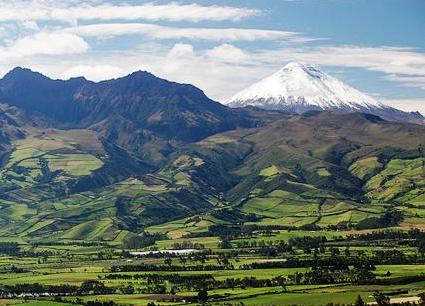
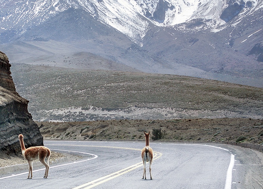
Do you want to drive along a picturesque road along which huge volcanoes, covered with dazzling white caps of snow and ice, were lined up? Then welcome to Ecuador , to the Pan-American transcontinental highway! The section of this wide multi-lane motorway with excellent coverage is laid along a narrow valley between two mountain ranges. Every day thousands of cars leave from Quito to the south and sweep past the sky-bound peaks, among them the 9 most famous volcanoes of Ecuador. Such a romantic name appeared with the light hand of the traveler Alexander Humboldt, who explored Ecuadorian volcanoes in 1802 and was shocked by the beauty of these places.
Majestic peaks are waiting for you!
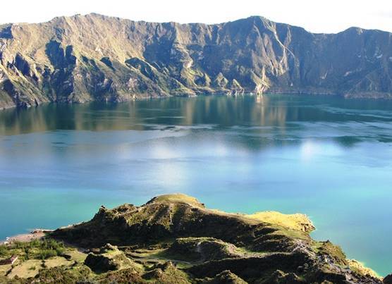
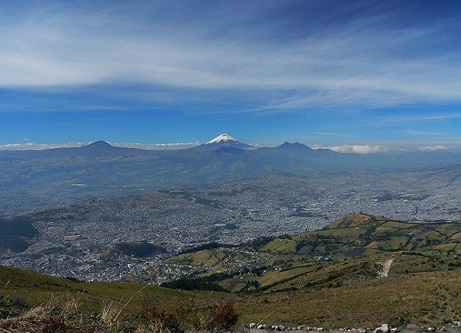
The beginning of the Avenue of Volcanoes is in Quito itself, located on the eastern slopes of the large active volcano Pichincha. The last eruption was recorded in 1999, however, no damage, except a thin layer of ash in the streets, it did not bring. Ascent to Pichincha is very popular, especially since from Quito to the volcano you can get by using the highest mountain cableway in the world - Teleferico. Departing from Quito along the highway to the south, on the sides you can see peaks of the volcanoes of Antisan , Cotopaxi and Ileniz Sur. Not far from the latter there is a very beautiful lake Kilotoa. Cotopaxi is one of the most famous and popular volcanoes in Ecuador, climbing it by anyone can take 5-8 hours. Further south - a huge volcano Sangai, whose name translates as "scare". It is this constantly erupting volcano that has been doing for the past hundred years. The last eruption was recorded in 2006-2007. Next to it - the volcano Tungurahua, a powerful eruption of which occurred in the spring of 2016. Surprisingly, with such active volcanic activity, the area along Volcanoes Avenue is densely populated, residents perceive the smoking tops as a matter of course. Another giant among the volcanoes, Chimborazo , has a height of up to 6300 m (according to various sources) and is the highest point of Ecuador . At its foot, the river Guayas originates, the largest water artery, the symbol of the country.
| | |
Road through the clouds
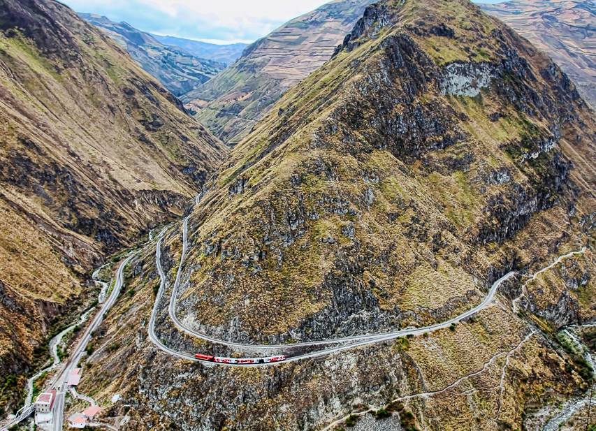
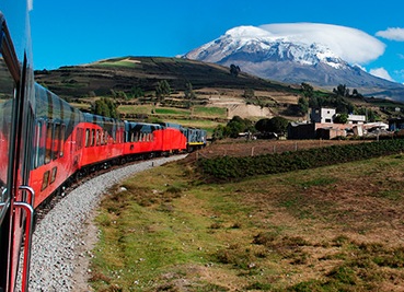
For fans of extreme and sharp impressions, you can look at the Avenue of Volcanoes from the train window, which travels through narrow gorges and overhead bridges thrown across monstrous abysses. This is the route "The Devil's Nose" , which has earned fame as one of the most dangerous in the world. Recently, the tourist department of Ecuador has received permission from the railroad owner to add a separate tourist car to the trains. The route begins in the highlands, in the town of Riobambe , runs along the volcano Chimborazo and descends into the real tropical jungles in the Simbabwe area. Despite the comfortable conditions in the car, tourists prefer to follow the example of local residents - on the roof, because there is a stunning view from there. And this is the only option to get to the beautiful highlands of Ecuador.
| | |
How to get there?
The Avenue of Volcanoes begins in the southern part of Quito and descends 300 km to the south, to the high-mountain city of Cuenca . The railway route has a length of about 100 km, begins in the town of Riobamba and also almost reaches Cuenca. Return from Cuenca to Quito can be a local airline flight, admiring the Avenue of Volcanoes again, but already from the air.
| | | |
| | | |