Impressions of a trip to New Zealand will be complete only if you include in your route visiting national parks. On a relatively small area of the New Zealand Islands, nature has created a variety of forms of relief; here and stunning mountain volcanic landscapes with glaciers and lakes, and tropical forests with river valleys and waterfalls. The Government of New Zealand has been engaged for more than a century in providing conditions for preserving and increasing the number of endemic representatives of flora and fauna by creating protected areas in different regions of the country.
In the territory of New Zealand, there are 14 national parks. Below we list the most interesting and popular ones.
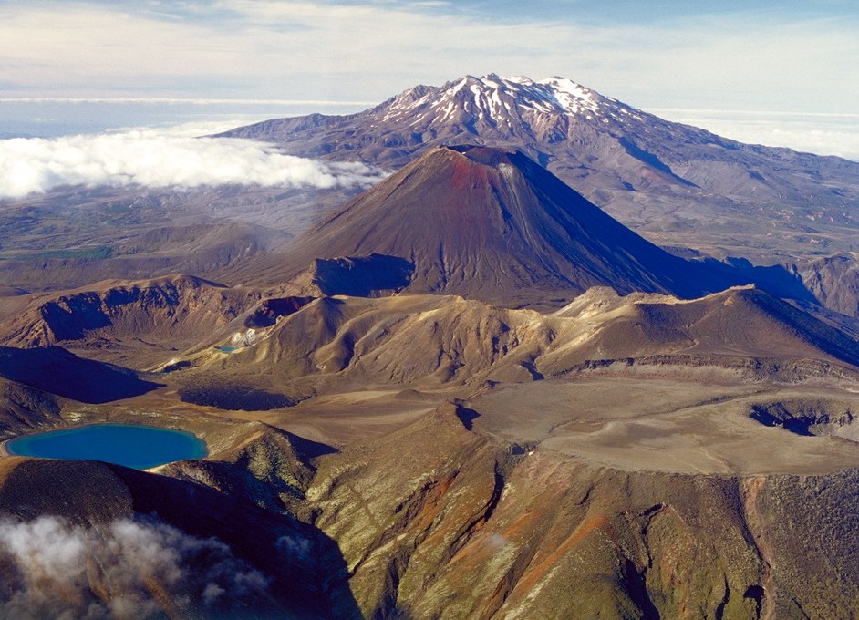
Tongariro National Park
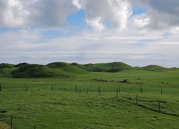
The oldest park in New Zealand and one of the oldest in the world. Today, the area of Tongariro National Park is 796 square kilometers. On its territory extends a mountain chain of extinct volcanoes, but there are three active volcanoes - Ruapehu, Ngaurupuoke and Tongariro. On the slopes of Ngauropohoe, the famous trilogy "The Lord of the Rings" was filmed, and the volcano "played a role" of Orodruin - the Rock Mountain, in the bowels of which the legendary ring of Omnipotence was forged. In this park there is one of the best walking routes in the world with a length of 20 km, there are places for stops and observation platforms for stunning panoramic photographs.
| | |
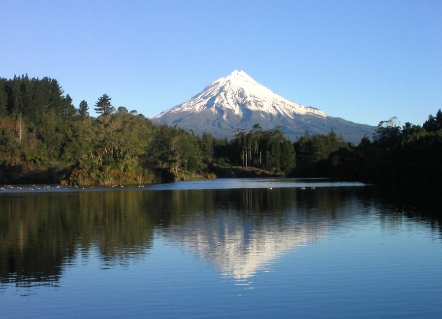
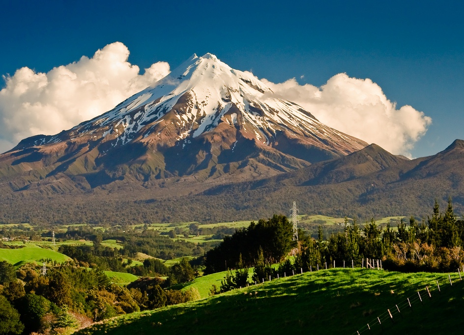
Egmont National Park
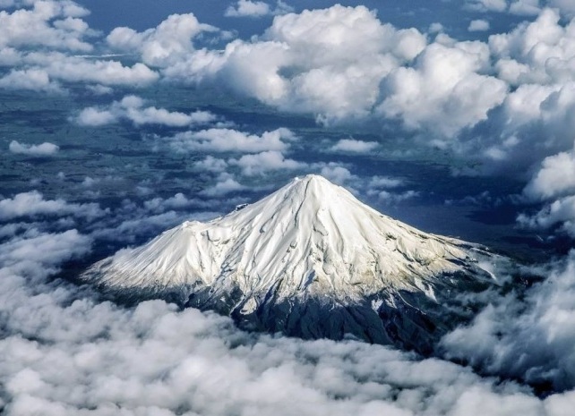
A small park with an area of only 335 sq.km. is located in the west of the North Island . In the center of the park is the Egmont volcano, a mountain 2518 high, which has a surprising resemblance to Mount Fuji in Japan. This circumstance determined the popularity of the park with the directors of blockbusters: footage with a view of Egmont can be seen in the film "The Last Samurai".
The volcano is considered to be asleep, although 300 years ago it terrified the inhabitants of the surrounding settlements. Ascent to the volcano is possible by all physically strong people and takes 5-6 hours. From the attractions of the park you should pay attention to the "Goblin Forest", the accumulation of curved trees covered with dense moss and a unique high-mountain bog covered with a layer of moss-sphagnum
| | | |
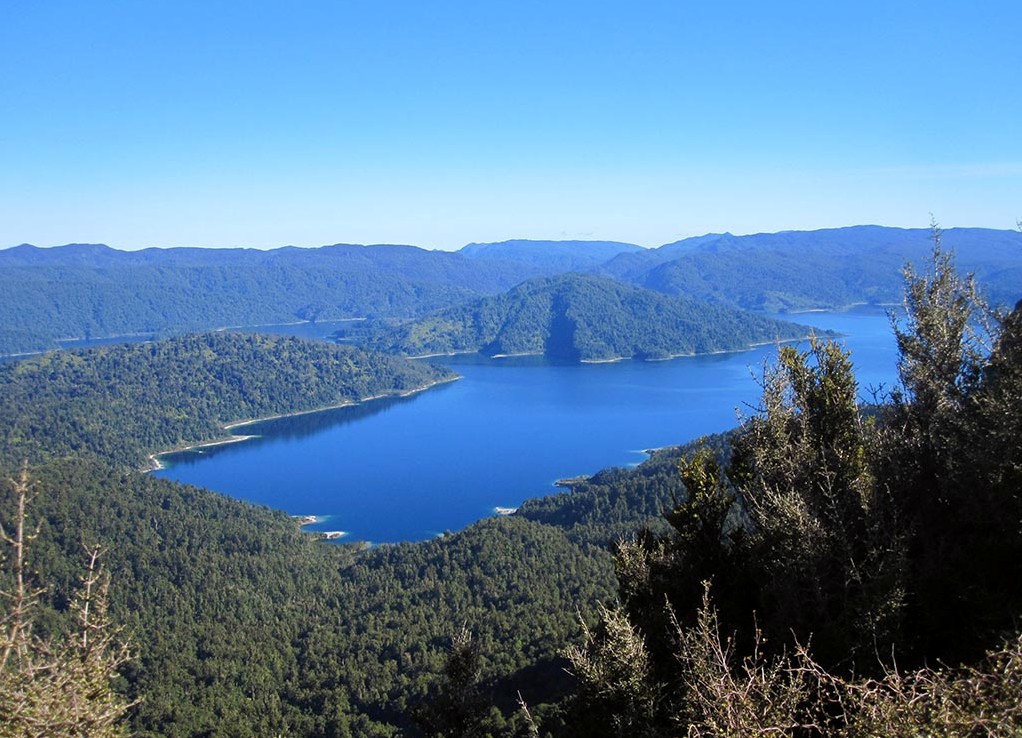
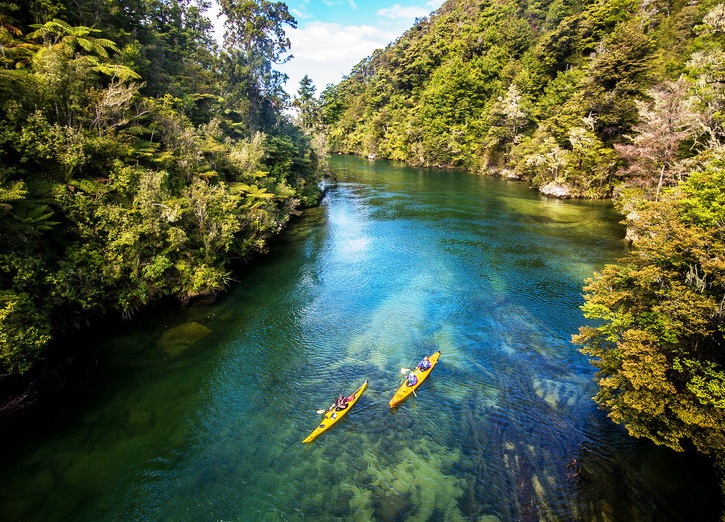
National Park Te Urevera
The largest park on the North Island covers an area of 2,127 square kilometers. In its center, surrounded on all sides by dense forests, is Lake Wakikremoana - a unique place for southern latitudes, reminiscent of its steep and winding fjord shores. The lake was formed due to a huge landslide, overlapping the river of the same name.
| | |
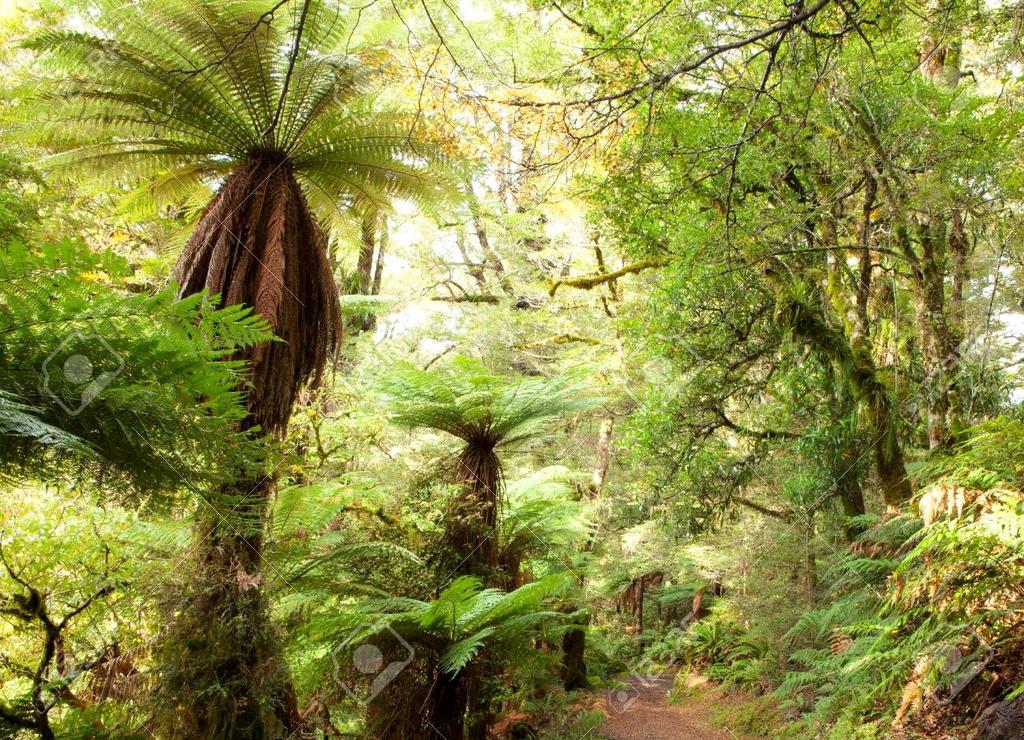
There are two walking routes in the park: one of them goes along the lake and allows you to fully enjoy the scenery, the second is laid through the forest of Phirinaki, a living monument to the virgin forests of New Zealand. The second route is considered the most "wild" trail on the entire North Island. Visitors will see more than 650 species of vegetation, rivers, lagoons and waterfalls, special ecological zones with interesting information. The park is attractive for ecotourism lovers - hikers, kayakers and fishermen.
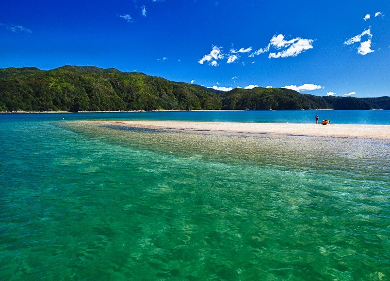
Abel Tasman National Park
The smallest national park has an area of 225 square kilometers. is considered to be the most beautiful park in New Zealand. Its main asset is the long stretches of beaches with golden sand, framed by a luxurious primeval forest. In the bays and bays that wash the park from the west, the water is crystal clear and has an excellent turquoise hue.
| | |
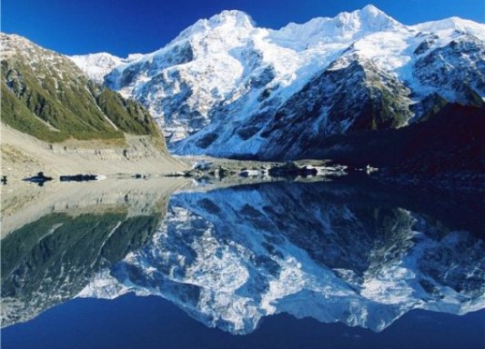
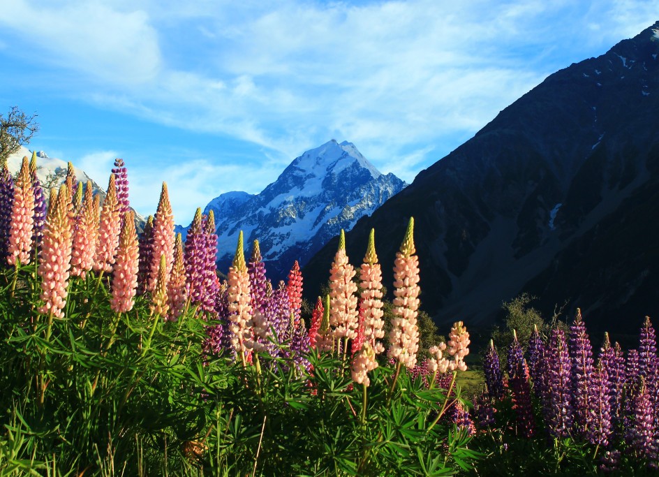
Aoraki / Mount Cook National Park
If the North Island is known for its volcanic relief, then the visiting card of the South Island is high mountains. In the Aoraki / Mount Cook National Park , covering an area of 707 square kilometers, there are more than 140 peaks over 2000 m high. The highest peak of New Zealand is Mount Cook, which the Maori call Aoraki ("Piercing Clouds"), is located in the South Alps, near the sea coast. The height of the mountain Cook - 3742 m.
| | |
On the territory of the park is the largest in New Zealand Tasman Glacier, 29 km long, to which you can swim by boat and even ride on its slopes on skis.
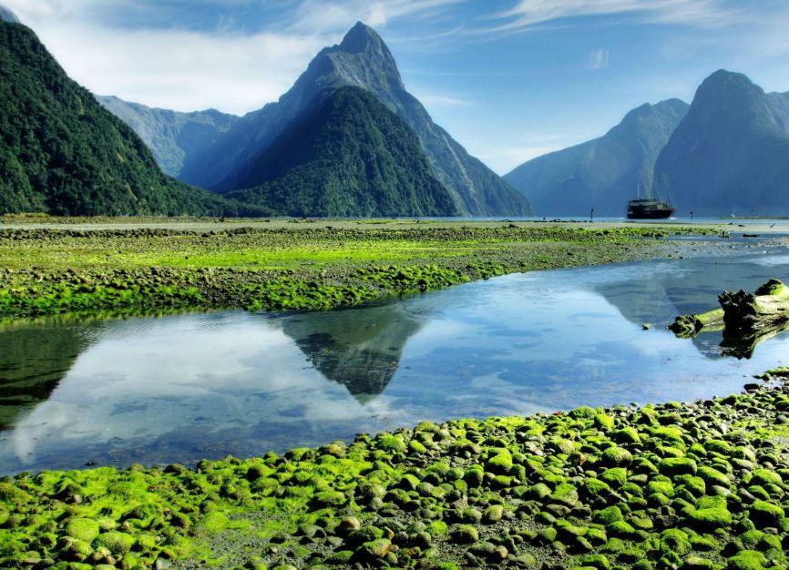
Fjordland National Park
In the mountainous north-western part of the South Island lies the country of the fjords - a desert land, where snow-capped mountains rise, between which lie deep lakes and glaciers, and the air is strikingly fresh. The largest national park Fiordland with relict nature and sacred places of Maori with the area of 12.5 thousand square kilometers is famous for its landscapes, it is cut by narrow bays with rocky coasts, hewn by glaciers in ancient times. Within the park is the Bay of Milford Sound, named Rudyard Kipling "the eighth wonder of the world." The bay is surrounded by mountain peaks up to 1200 m high and is considered one of the wettest places on the planet.
| | |
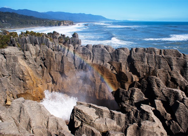
Paparoa National Park
One of the youngest parks, located on an area of 305 sq. Km on the west coast of the South Island . The local landscape is an exotic mix of forests, rocks and caves. Opened in 1987 to protect unique karst rocks from afforestation and mining. These places are known by cliffs - steep abrasion slopes of considerable height, and "devil holes", from which water jets break out periodically. Such geysers can be seen at high tide, when seawater rushes through numerous holes in limestone rocks. Local residents and tour companies organize excursions to the caves, the deepest of them - the cave Xanadu has a length of more than 5 km and is located on the ocean coast near the mountain ridge Paparoa.
| | |
The peculiarity of this park is the presence of a unique variety of forests, which is not found in any other plain part of New Zealand.